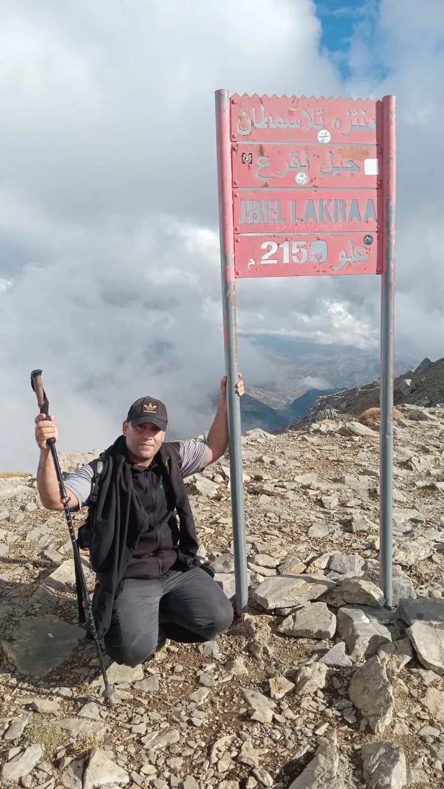
The mountain has three names: Lakraa, El Aqraa and Echhab. All refer to the same summit in Chefchaouen province, inside Talassemtane National Park. It is the highest point of the western Rif and one of the highest peaks of the whole Rif range.
Mountain card
| Place | Altitude | Tribe or commune | Province |
|---|---|---|---|
| Jbel Lakraa | 2159 m | Beni Zejel and Akhmas | Chefchaouen province |
| Jbel Tissouka | 2122 m | — | Chefchaouen province |
| Jbel Tizirane | 2106 m | Beni Khaled | Chefchaouen province |
A mountain between two tribes
Lakraa is a special case in tribal geography. Its summit is a natural boundary between two territories: one slope belongs to the Beni Zejel, the other to the Akhmas. So it tops the ranking of the highest peak of each tribe twice. It is not alone: other shared peaks are explained in peaks between two tribes.
The neighbours: Tissouka, Tizirane and Makou
Right behind it comes Jbel Tissouka, at about 2122 metres, the second-highest peak of the western Rif and one of the hardest climbs in northern Morocco. Then Jbel Tizirane, at about 2106 metres, in the Beni Khaled lands. Jbel Talassemtane, at about 1941 metres, is the summit that gave the park its name.
On Lakraa's slope, in Bab Taza commune, lies the village of Makou, in the Akhmas Oulia lands. Locally its name is pronounced with a K close to a G: “Mago”.
The fir forest on the way up
The climb usually passes through the Moroccan fir forest, a rare tree that grows naturally only in these mountains, before coming out onto pastures and limestone rock up to the summit. To learn about this tree: the Moroccan fir, the rare tree of Talassemtane.
Climbing Lakraa with a guide
The route led by mountain guide Imad Ben Yahya to the summit is about 16 kilometres long, with about 1050 metres of ascent, and takes about 7 hours. It starts from Azilane or from the Talassemtane refuge, depending on the route chosen. It is a hard hike that needs good fitness and a full day. In winter the summit is covered in snow, so the route is adapted or postponed depending on the weather.
Before you go, read climbing Jbel Lakraa: how to prepare and hiking in winter and snow.
Frequently asked questions
How high is Jbel Lakraa?
About 2159 metres.
Where is Jbel Lakraa?
In Chefchaouen province, inside Talassemtane National Park, between the lands of the Beni Zejel and the Akhmas.
Is climbing Lakraa hard?
Yes: guide Imad's route is about 16 kilometres with about 1050 metres of ascent in about 7 hours, and needs good fitness.